Introduction
Natural disasters such as floods, hurricanes, earthquakes, wildfires, heatwaves, landslides, and cyclones are becoming more frequent, more intense, and harder to predict with traditional models alone. Governments and emergency management agencies are under increasing pressure to move from reactive disaster response to predictive, AI-driven disaster preparedness. This is where AI Disaster Response Forecasting Tools play a critical role.
These systems use artificial intelligence, machine learning, geospatial analytics, satellite imagery processing, climate modeling, and real-time sensor data to forecast disaster risks and support proactive response planning. Unlike traditional forecasting systems that rely primarily on historical weather or seismic data, AI-based platforms integrate multiple data sources such as IoT sensors, satellite feeds, river and ocean levels, seismic activity, traffic flow, population density, and even social media signals to generate early warnings and scenario simulations.
Modern AI disaster forecasting tools help governments and organizations anticipate impact zones, optimize evacuation routes, allocate emergency resources, and reduce loss of life and infrastructure damage. Many platforms also provide real-time dashboards, predictive simulations, and automated alerts that improve coordination between disaster management agencies, first responders, and public safety departments.
As climate risk increases globally, AI-powered forecasting is becoming essential for building resilient cities and disaster-ready infrastructure.
Common use cases include:
- Flood prediction and early warning systems
- Wildfire risk detection and spread modeling
- Earthquake impact analysis
- Cyclone and hurricane path prediction
- Landslide risk forecasting
- Heatwave and drought prediction
- Evacuation route optimization
- Emergency resource allocation planning
When evaluating AI Disaster Response Forecasting Tools, organizations should consider:
- Prediction accuracy and model reliability
- Real-time data processing capability
- Integration with satellite and IoT data sources
- Geospatial analytics and mapping features
- Early warning system capabilities
- Simulation and scenario modeling
- Scalability across regions and countries
- Latency and real-time responsiveness
- Explainable AI and transparency
- API and system integration support
- Data security and governance
- Multi-hazard forecasting capability
Best for: National disaster management authorities, meteorological departments, smart city programs, defense and homeland security agencies, environmental monitoring organizations, insurance risk modeling teams, infrastructure planners, and humanitarian response organizations.
Not ideal for: Small organizations without access to geospatial data, businesses that do not operate in high-risk regions, or teams that do not require predictive disaster modeling.
What’s Changed in AI Disaster Response Forecasting Tools
AI has significantly transformed disaster forecasting from static prediction models into dynamic, real-time intelligence systems.
Key trends include:
- Multi-source data fusion combining satellite, IoT, and climate models.
- Real-time disaster prediction using streaming geospatial data.
- AI-powered climate modeling for long-term risk forecasting.
- Generative AI for disaster scenario simulation and planning.
- Integration with digital twin environments for cities and infrastructure.
- Edge AI for remote sensor-based disaster detection.
- Hyperlocal forecasting using high-resolution geospatial AI.
- Automated early warning systems integrated with mobile alerts.
- AI-driven evacuation planning and optimization.
- Predictive infrastructure risk scoring for resilience planning.
- Cross-border disaster intelligence sharing platforms.
- Explainable AI improving trust in forecasting decisions.
Quick Buyer Checklist
Before selecting an AI Disaster Response Forecasting Tool, ensure it includes:
- ✔ Multi-hazard prediction capability
- ✔ Real-time geospatial analytics
- ✔ Satellite and remote sensing integration
- ✔ IoT sensor data processing
- ✔ Early warning system support
- ✔ Scenario simulation and forecasting
- ✔ AI-based risk scoring
- ✔ High scalability for regional/national deployment
- ✔ API integration capabilities
- ✔ Dashboard and visualization tools
- ✔ Data governance and security controls
- ✔ Explainable AI outputs
- ✔ Low-latency real-time processing
- ✔ Cross-agency collaboration features
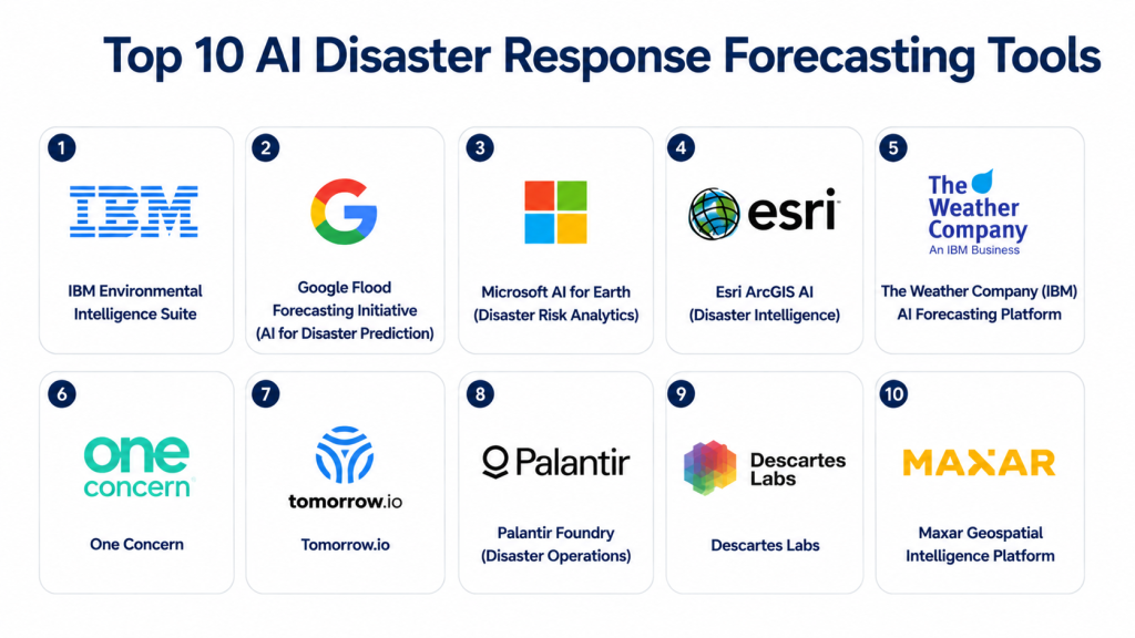
Top 10 AI Disaster Response Forecasting Tools
1 — IBM Environmental Intelligence Suite
One-line verdict: Best for enterprise-grade climate risk forecasting and disaster impact prediction using AI and geospatial analytics.
Short description
IBM Environmental Intelligence Suite uses AI, weather models, and geospatial data to forecast environmental risks, including floods, wildfires, and extreme weather events, helping organizations prepare proactive disaster response strategies.
Standout Capabilities
- AI-based weather forecasting
- Flood and wildfire risk prediction
- Geospatial analytics
- Climate risk modeling
- Real-time alerts
- Scenario simulation
- Satellite data integration
- Risk visualization dashboards
AI-Specific Depth
- Model support: IBM AI + climate prediction models
- RAG / Knowledge integration: Environmental and geospatial datasets
- Evaluation: Model validation and climate accuracy benchmarking
- Guardrails: Environmental risk governance controls
- Observability: Climate dashboards, prediction accuracy tracking, alert logs
Pros
- Strong climate intelligence capabilities
- High-quality geospatial analytics
- Enterprise scalability
Cons
- Complex setup
- Requires geospatial expertise
- Premium enterprise pricing
Security & Compliance
- SSO/SAML: Supported
- RBAC: Supported
- Audit logs: Supported
- Encryption: Supported
- Certifications: Not publicly stated
Deployment & Platforms
- Cloud
- Hybrid integrations
- Web dashboards
Integrations & Ecosystem
- Satellite data providers
- IoT sensor networks
- Government disaster systems
- GIS platforms
- Weather APIs
Pricing Model
Enterprise subscription.
Best-Fit Scenarios
- National disaster management
- Climate risk analysis
- Smart city resilience programs
2 — Google Flood Forecasting Initiative (AI for Disaster Prediction)
One-line verdict: Best for high-accuracy flood prediction using AI and large-scale hydrological modeling.
Short description
Google’s AI-driven flood forecasting system uses machine learning, river data, rainfall patterns, and terrain modeling to predict floods and issue early warnings in vulnerable regions.
Standout Capabilities
- Flood prediction modeling
- Real-time river level monitoring
- AI-based rainfall analysis
- Early warning alerts
- Hyperlocal forecasting
- Geospatial mapping
- Risk visualization
- Mobile alert integration
AI-Specific Depth
- Model support: Google ML + hydrological models
- RAG / Knowledge integration: River, rainfall, and terrain datasets
- Evaluation: Forecast accuracy monitoring and validation systems
- Guardrails: Environmental safety thresholds and alert rules
- Observability: Prediction dashboards, risk heatmaps, alert logs
Pros
- High flood prediction accuracy
- Strong geospatial intelligence
- Scalable cloud infrastructure
Cons
- Focused primarily on flood forecasting
- Requires integration for broader disaster use cases
- Cloud dependency
Security & Compliance
- SSO/SAML: Supported via Google Cloud IAM
- RBAC: Supported
- Audit logs: Supported
- Encryption: Supported
- Certifications: Not publicly stated
Deployment & Platforms
- Cloud
- API-based integration
- Web dashboards
Integrations & Ecosystem
- Google Earth Engine
- Satellite data systems
- Government disaster networks
- Weather data APIs
- Mobile alert systems
Pricing Model
Usage-based cloud model.
Best-Fit Scenarios
- Flood-prone regions
- National hydrology departments
- Smart city flood monitoring
3 — Microsoft AI for Earth (Disaster Risk Analytics)
One-line verdict: Best for integrating AI disaster forecasting with enterprise and government cloud ecosystems.
Short description
Microsoft AI for Earth combines AI, cloud computing, and geospatial analytics to support disaster forecasting, environmental monitoring, and climate resilience programs.
Standout Capabilities
- Disaster risk modeling
- AI geospatial analysis
- Climate forecasting
- Satellite data processing
- Early warning systems
- Scenario simulation
- Risk mapping
- Real-time analytics
AI-Specific Depth
- Model support: Azure AI + geospatial ML models
- RAG / Knowledge integration: Earth observation datasets and GIS systems
- Evaluation: Model performance tracking and validation tools
- Guardrails: Responsible AI frameworks and policy controls
- Observability: Azure monitoring dashboards, geospatial analytics logs
Pros
- Strong Microsoft ecosystem integration
- Flexible AI model development
- Scalable cloud infrastructure
Cons
- Requires Azure expertise
- Not a single turnkey disaster product
- Setup complexity for beginners
Security & Compliance
- SSO/SAML: Supported
- RBAC: Supported
- Audit logs: Supported
- Encryption: Supported
- Certifications: Not publicly stated
Deployment & Platforms
- Cloud (Azure)
- Hybrid deployments
- Web dashboards
Integrations & Ecosystem
- Azure services
- GIS platforms
- Satellite data providers
- Government disaster systems
- IoT sensor networks
Pricing Model
Cloud subscription-based.
Best-Fit Scenarios
- Government disaster agencies
- Smart city resilience programs
- Enterprise climate risk planning
4 — Esri ArcGIS AI (Disaster Intelligence)
One-line verdict: Best for geospatial-driven disaster forecasting and real-time mapping intelligence.
Short description
Esri ArcGIS AI integrates geospatial analytics and AI to provide advanced disaster forecasting, mapping, and real-time situational awareness for emergency management teams.
Standout Capabilities
- Geospatial disaster mapping
- AI risk prediction
- Real-time visualization
- Scenario simulation
- Emergency response mapping
- Satellite integration
- Infrastructure risk analysis
- Early warning dashboards
AI-Specific Depth
- Model support: Geospatial ML + AI models
- RAG / Knowledge integration: GIS databases and spatial datasets
- Evaluation: Map accuracy validation and model tuning
- Guardrails: Spatial data governance and access controls
- Observability: Geospatial dashboards, risk overlays, analytics logs
Pros
- Industry-leading GIS platform
- Excellent visualization capabilities
- Strong disaster mapping tools
Cons
- Requires GIS expertise
- Complex configuration
- Premium licensing
Security & Compliance
- SSO/SAML: Supported
- RBAC: Supported
- Audit logs: Supported
- Encryption: Supported
- Certifications: Not publicly stated
Deployment & Platforms
- Cloud
- On-premises GIS deployments
- Hybrid systems
Integrations & Ecosystem
- Government GIS systems
- Satellite data providers
- Emergency command centers
- IoT sensors
- Disaster management systems
Pricing Model
Enterprise GIS licensing.
Best-Fit Scenarios
- Emergency mapping centers
- National disaster agencies
- Smart city GIS systems
5 — The Weather Company (IBM) AI Forecasting Platform
One-line verdict: Best for high-resolution weather-driven disaster forecasting and early warning systems.
Short description
The Weather Company uses AI and meteorological modeling to deliver precise weather forecasts, extreme weather alerts, and disaster risk predictions for governments and enterprises.
Standout Capabilities
- AI weather forecasting
- Severe weather alerts
- Disaster risk prediction
- Real-time updates
- Climate modeling
- Hyperlocal forecasting
- Visualization dashboards
- Early warning systems
AI-Specific Depth
- Model support: Proprietary meteorological AI models
- RAG / Knowledge integration: Weather and climate datasets
- Evaluation: Forecast accuracy tracking and validation systems
- Guardrails: Weather alert thresholds and safety policies
- Observability: Forecast dashboards, alert logs, prediction monitoring
Pros
- Highly accurate weather modeling
- Strong early warning capabilities
- Scalable forecasting systems
Cons
- Weather-focused (limited non-weather disasters)
- Enterprise integration required
- Premium pricing
Security & Compliance
- SSO/SAML: Supported
- RBAC: Supported
- Audit logs: Supported
- Encryption: Supported
- Certifications: Not publicly stated
Deployment & Platforms
- Cloud
- API-based services
- Web dashboards
Integrations & Ecosystem
- Government meteorological systems
- Emergency alert platforms
- IoT weather sensors
- GIS systems
- Disaster management platforms
Pricing Model
Enterprise subscription / API usage
Best-Fit Scenarios
- Weather agencies
- Disaster early warning systems
- Smart city climate monitoring
6 — One Concern
One-line verdict: Best for digital twin-based disaster forecasting and infrastructure resilience planning.
Short description
One Concern combines artificial intelligence, digital twins, geospatial analytics, and infrastructure modeling to forecast the impact of natural disasters on cities, transportation systems, utilities, and public infrastructure.
Standout Capabilities
- Digital twin disaster simulation
- Infrastructure impact forecasting
- Earthquake and flood modeling
- Critical asset prioritization
- Emergency resource planning
- Risk visualization
- AI-powered resilience analysis
- Real-time situational awareness
AI-Specific Depth
- Model support: Proprietary predictive AI models
- RAG / Knowledge integration: Infrastructure datasets, GIS systems, engineering data
- Evaluation: Continuous model validation and disaster scenario testing
- Guardrails: Infrastructure governance and planning controls
- Observability: Digital twin dashboards, impact analytics, risk heatmaps
Pros
- Excellent infrastructure risk forecasting
- Advanced digital twin capabilities
- Strong government planning support
Cons
- Enterprise implementation complexity
- Requires detailed infrastructure data
- Premium pricing
Security & Compliance
- SSO/SAML: Supported
- RBAC: Supported
- Audit logs: Supported
- Encryption: Supported
- Certifications: Not publicly stated
Deployment & Platforms
- Cloud
- Hybrid
- Web-based dashboards
Integrations & Ecosystem
- GIS platforms
- Smart city infrastructure
- Government emergency systems
- Engineering databases
- IoT sensor platforms
Pricing Model
Enterprise subscription.
Best-Fit Scenarios
- Smart city resilience planning
- Infrastructure disaster modeling
- Government emergency preparedness
7 — Tomorrow.io
One-line verdict: Best for hyperlocal weather intelligence and AI-powered operational disaster forecasting.
Short description
Tomorrow.io provides AI-enhanced weather intelligence that helps governments, aviation agencies, logistics providers, and emergency response teams anticipate weather-driven disasters and improve operational planning.
Standout Capabilities
- Hyperlocal forecasting
- Weather intelligence
- AI predictive analytics
- Operational risk scoring
- Severe weather alerts
- Climate monitoring
- Forecast visualization
- API-based forecasting
AI-Specific Depth
- Model support: Proprietary weather AI models
- RAG / Knowledge integration: Weather, radar, and satellite datasets
- Evaluation: Forecast accuracy monitoring
- Guardrails: Alert thresholds and operational policies
- Observability: Weather dashboards, forecast analytics, API monitoring
Pros
- Excellent hyperlocal weather prediction
- Fast cloud deployment
- Strong API ecosystem
Cons
- Focused mainly on weather-related disasters
- Limited infrastructure modeling
- Enterprise licensing
Security & Compliance
- SSO/SAML: Supported
- RBAC: Supported
- Audit logs: Supported
- Encryption: Supported
- Certifications: Not publicly stated
Deployment & Platforms
- Cloud
- API-based
- Web dashboards
Integrations & Ecosystem
- Weather APIs
- GIS platforms
- Mobile applications
- Emergency management systems
- Enterprise planning tools
Pricing Model
Subscription and API-based pricing.
Best-Fit Scenarios
- Weather-sensitive operations
- Emergency preparedness
- Transportation planning
8 — Palantir Foundry (Disaster Operations)
One-line verdict: Best for integrating multiple disaster intelligence sources into a unified operational platform.
Short description
Palantir Foundry helps governments and emergency management organizations combine satellite imagery, logistics, infrastructure, weather, and operational data into a single AI-powered disaster response platform.
Standout Capabilities
- Multi-source data integration
- AI operational intelligence
- Resource optimization
- Disaster response dashboards
- Scenario planning
- Logistics coordination
- Decision support
- Predictive analytics
AI-Specific Depth
- Model support: Multi-model AI platform
- RAG / Knowledge integration: Enterprise knowledge repositories and operational datasets
- Evaluation: Workflow validation and simulation testing
- Guardrails: Role-based governance and policy enforcement
- Observability: Operational dashboards, model monitoring, analytics
Pros
- Excellent data integration capabilities
- Strong operational decision support
- Highly scalable
Cons
- Complex implementation
- Requires experienced deployment teams
- Premium enterprise investment
Security & Compliance
- SSO/SAML: Supported
- RBAC: Supported
- Audit logs: Supported
- Encryption: Supported
- Certifications: Not publicly stated
Deployment & Platforms
- Cloud
- Hybrid
- Enterprise deployments
Integrations & Ecosystem
- Government systems
- GIS platforms
- Satellite imagery
- Logistics systems
- IoT data platforms
Pricing Model
Enterprise licensing.
Best-Fit Scenarios
- National disaster operations centers
- Humanitarian logistics
- Multi-agency coordination
9 — Descartes Labs
One-line verdict: Best for AI-powered satellite imagery analysis and large-scale geospatial intelligence.
Short description
Descartes Labs uses machine learning and satellite imagery analytics to monitor environmental changes, detect disaster risks, and support predictive disaster response across large geographic regions.
Standout Capabilities
- Satellite image analytics
- AI geospatial intelligence
- Land-use monitoring
- Environmental change detection
- Predictive disaster mapping
- Remote sensing analytics
- Large-scale data processing
- Visualization dashboards
AI-Specific Depth
- Model support: Machine learning and geospatial AI models
- RAG / Knowledge integration: Satellite imagery repositories and GIS datasets
- Evaluation: Model validation using historical imagery
- Guardrails: Secure geospatial data governance
- Observability: Image analytics dashboards and monitoring tools
Pros
- Exceptional satellite analytics
- High scalability
- Strong remote sensing capabilities
Cons
- Specialized geospatial expertise required
- Limited operational dispatch features
- Enterprise-focused deployment
Security & Compliance
- SSO/SAML: Supported
- RBAC: Supported
- Audit logs: Supported
- Encryption: Supported
- Certifications: Not publicly stated
Deployment & Platforms
- Cloud
- Web-based analytics
Integrations & Ecosystem
- Satellite providers
- GIS platforms
- Government agencies
- Climate datasets
- AI analytics tools
Pricing Model
Enterprise subscription.
Best-Fit Scenarios
- National environmental monitoring
- Disaster mapping
- Climate intelligence
10 — Maxar Geospatial Intelligence Platform
One-line verdict: Best for high-resolution satellite imagery supporting disaster assessment and emergency planning.
Short description
Maxar provides satellite imagery, AI-assisted image analysis, and geospatial intelligence that help governments assess disaster impacts, monitor affected regions, and coordinate emergency response.
Standout Capabilities
- High-resolution satellite imagery
- AI image interpretation
- Disaster damage assessment
- Change detection
- Infrastructure monitoring
- Geospatial intelligence
- Rapid imagery updates
- Mapping services
AI-Specific Depth
- Model support: AI image analysis models
- RAG / Knowledge integration: Satellite imagery repositories and mapping systems
- Evaluation: Image validation and quality monitoring
- Guardrails: Secure imagery management policies
- Observability: Geospatial dashboards and monitoring tools
Pros
- Excellent satellite imagery quality
- Strong disaster assessment capabilities
- Trusted government solution
Cons
- Focused primarily on imagery
- Requires GIS expertise
- Enterprise pricing
Security & Compliance
- SSO/SAML: Supported
- RBAC: Supported
- Audit logs: Supported
- Encryption: Supported
- Certifications: Not publicly stated
Deployment & Platforms
- Cloud
- Hybrid
- GIS platforms
Integrations & Ecosystem
- Government GIS systems
- Emergency operations centers
- Satellite imagery platforms
- Mapping tools
- Infrastructure monitoring systems
Pricing Model
Enterprise licensing.
Best-Fit Scenarios
- Disaster damage assessment
- Emergency mapping
- National response coordination
Comparison Table
| Tool Name | Best For | Deployment | Model Flexibility | Strength | Watch-Out | Public Rating |
|---|---|---|---|---|---|---|
| IBM Environmental Intelligence Suite | Climate risk forecasting | Cloud / Hybrid | Proprietary AI | Enterprise climate analytics | Premium pricing | N/A |
| Google Flood Forecasting Initiative | Flood prediction | Cloud | AI + Hydrological models | Flood forecasting accuracy | Flood-focused | N/A |
| Microsoft AI for Earth | Environmental AI | Cloud | Multi-model | Azure ecosystem | Requires Azure expertise | N/A |
| Esri ArcGIS AI | GIS disaster intelligence | Cloud / Hybrid | Geospatial AI | Industry-leading GIS | GIS expertise required | N/A |
| The Weather Company | Weather forecasting | Cloud | Proprietary AI | Hyperlocal weather | Weather-focused | N/A |
| One Concern | Infrastructure resilience | Cloud | Proprietary AI | Digital twins | Complex deployment | N/A |
| Tomorrow.io | Weather intelligence | Cloud | Proprietary AI | Hyperlocal forecasts | Limited non-weather use | N/A |
| Palantir Foundry | Disaster operations | Cloud / Hybrid | Multi-model | Operational intelligence | Enterprise complexity | N/A |
| Descartes Labs | Satellite analytics | Cloud | Geospatial AI | Remote sensing | Specialized platform | N/A |
| Maxar Geospatial Intelligence | Satellite imagery | Cloud / Hybrid | AI image analysis | High-resolution imagery | Imagery-centric | N/A |
Scoring & Evaluation (Transparent Rubric)
The following scores compare AI Disaster Response Forecasting platforms across prediction capability, operational intelligence, AI reliability, integration, governance, scalability, and disaster management readiness. Scores are intended as a comparative buying guide rather than absolute benchmarks. Organizations should validate performance using their own environmental data, disaster scenarios, and operational workflows before deployment.
| Tool | Core | Reliability / Eval | Guardrails | Integrations | Ease | Perf / Cost | Security / Admin | Support | Weighted Total |
|---|---|---|---|---|---|---|---|---|---|
| IBM Environmental Intelligence Suite | 9.8 | 9.7 | 9.6 | 9.7 | 8.8 | 9.1 | 9.7 | 9.5 | 9.54 |
| Esri ArcGIS AI | 9.7 | 9.6 | 9.5 | 9.8 | 8.6 | 9.0 | 9.6 | 9.4 | 9.47 |
| Palantir Foundry | 9.7 | 9.5 | 9.6 | 9.7 | 8.5 | 9.0 | 9.6 | 9.4 | 9.43 |
| One Concern | 9.6 | 9.5 | 9.5 | 9.5 | 8.6 | 9.0 | 9.5 | 9.3 | 9.37 |
| Google Flood Forecasting Initiative | 9.5 | 9.6 | 9.3 | 9.2 | 9.0 | 9.3 | 9.3 | 9.2 | 9.33 |
| Microsoft AI for Earth | 9.4 | 9.4 | 9.4 | 9.5 | 8.8 | 9.1 | 9.4 | 9.2 | 9.31 |
| Tomorrow.io | 9.3 | 9.3 | 9.2 | 9.2 | 9.2 | 9.3 | 9.2 | 9.1 | 9.22 |
| Maxar Geospatial Intelligence | 9.3 | 9.2 | 9.2 | 9.1 | 8.9 | 9.0 | 9.3 | 9.2 | 9.17 |
| Descartes Labs | 9.2 | 9.2 | 9.1 | 9.2 | 8.8 | 9.0 | 9.2 | 9.1 | 9.12 |
| The Weather Company | 9.2 | 9.3 | 9.1 | 9.0 | 9.0 | 9.1 | 9.2 | 9.1 | 9.11 |
Top 3 for Government Disaster Agencies
- IBM Environmental Intelligence Suite
- Esri ArcGIS AI
- Palantir Foundry
Top 3 for Smart Cities
- One Concern
- Esri ArcGIS AI
- Tomorrow.io
Top 3 for Climate & Environmental Monitoring
- IBM Environmental Intelligence Suite
- Google Flood Forecasting Initiative
- The Weather Company
Which AI Disaster Response Forecasting Tool Is Right for You?
Selecting the right AI Disaster Response Forecasting platform depends on the type of hazards you face, geographic complexity, data availability, and whether your focus is on prediction, simulation, or operational response coordination. While all tools in this category aim to reduce disaster impact, they differ significantly in how they combine satellite intelligence, IoT sensing, geospatial modeling, and AI-driven forecasting.
Modern disaster preparedness is no longer about reacting to events—it is about anticipating them with enough precision to act early. The best systems combine real-time data ingestion, multi-hazard modeling, explainable AI, and cross-agency coordination capabilities.
Small Regions / Local Disaster Management Units
Smaller regions typically need practical forecasting tools that are easy to deploy and focused on specific hazards like floods, storms, or heatwaves.
Key priorities:
- Simple dashboards
- Flood or weather-specific forecasting
- Low infrastructure complexity
- Mobile alert integration
- Affordable cloud deployment
Recommended tools
- Google Flood Forecasting Initiative
- Tomorrow.io
- The Weather Company
These tools provide strong early warning capabilities without heavy infrastructure requirements.
Mid-Sized Regions / State-Level Agencies
State-level disaster management authorities require multi-hazard forecasting and better geospatial intelligence.
Important evaluation criteria:
- Multi-hazard prediction (flood, wildfire, cyclone)
- GIS integration
- Scenario simulation
- Early warning systems
- IoT + satellite data fusion
- Resource planning dashboards
Recommended tools
- Microsoft AI for Earth
- Esri ArcGIS AI
- IBM Environmental Intelligence Suite
These platforms balance prediction accuracy with operational usability.
National Disaster Management Authorities
National agencies require large-scale predictive intelligence across multiple hazard types and regions.
Priority capabilities:
- Country-wide forecasting
- Multi-layer geospatial intelligence
- Real-time risk scoring
- Infrastructure impact analysis
- Cross-agency coordination
- AI-based early warning automation
Recommended tools
- IBM Environmental Intelligence Suite
- Palantir Foundry
- Esri ArcGIS AI
- One Concern
These systems support mission-critical, nationwide disaster readiness programs.
Smart Cities & Urban Resilience Programs
Smart cities need highly localized forecasting combined with infrastructure and population intelligence.
Key capabilities:
- Hyperlocal predictions
- Digital twin simulation
- Infrastructure risk modeling
- Traffic and evacuation optimization
- Real-time dashboards
- IoT integration
Recommended tools
- One Concern
- Esri ArcGIS AI
- Tomorrow.io
These platforms help cities simulate disaster impact before it happens.
Climate & Environmental Monitoring Agencies
Environmental agencies focus on long-term climate trends, ecosystem monitoring, and extreme weather prediction.
Important evaluation criteria:
- Climate modeling
- Satellite image analysis
- Long-term forecasting
- Environmental change detection
- Multi-decade risk simulation
Recommended tools
- IBM Environmental Intelligence Suite
- Descartes Labs
- Maxar Geospatial Intelligence
- Microsoft AI for Earth
These tools are optimized for environmental intelligence at scale.
Budget vs Premium Solutions
Budget-Conscious Deployments
Organizations starting their disaster forecasting journey can begin with focused, API-driven systems.
Recommended tools:
- Tomorrow.io
- Google Flood Forecasting Initiative
- The Weather Company
These offer strong forecasting with lower setup complexity.
Premium Enterprise & Government Platforms
Large governments and infrastructure agencies require advanced AI, simulation, and geospatial intelligence.
Recommended tools:
- IBM Environmental Intelligence Suite
- Esri ArcGIS AI
- Palantir Foundry
- One Concern
- Maxar Geospatial Intelligence
These platforms provide full-scale disaster intelligence ecosystems.
Build vs Buy
Some organizations consider building custom disaster forecasting systems using open data, satellite feeds, and machine learning models.
Consider Building If
- You have strong geospatial AI engineering teams
- You require highly localized or proprietary forecasting models
- You control large-scale sensor or satellite datasets
- You need sovereign disaster intelligence infrastructure
Consider Buying If
- You need fast deployment of early warning systems
- You require validated and tested forecasting models
- You lack internal geospatial AI expertise
- You need multi-hazard forecasting across regions
- You want integrated dashboards and alert systems
For most agencies, buying an established platform is faster, safer, and more reliable than building from scratch.
Implementation Playbook (30 / 60 / 90 Days)
Successful deployment of AI Disaster Response Forecasting systems requires phased adoption, data integration, and continuous model validation.
First 30 Days – Data & Risk Mapping Setup
Focus on establishing baseline datasets and identifying high-risk zones.
Key activities:
- Integrate satellite and weather data sources
- Map historical disaster events
- Identify high-risk regions
- Configure forecasting models
- Set alert thresholds
- Establish GIS layers
- Connect IoT sensor feeds
- Define KPIs for early warning systems
- Train operational teams
- Run pilot predictions
Success metrics:
- Forecast accuracy
- Alert timeliness
- Data coverage completeness
- System latency
- Model reliability
Days 31–60 – Expansion & Integration
Expand forecasting capabilities across multiple hazard types and systems.
Key activities:
- Enable multi-hazard forecasting
- Integrate emergency response systems
- Improve geospatial accuracy
- Add scenario simulation models
- Deploy dashboards for stakeholders
- Integrate mobile alert systems
- Expand IoT coverage
- Improve AI model tuning
- Strengthen governance controls
- Conduct stakeholder training
Days 61–90 – Optimization & Scaling
Scale forecasting across regions and improve predictive accuracy.
Key activities:
- Expand to national/regional coverage
- Optimize model performance
- Reduce false positives in alerts
- Enhance disaster simulation models
- Improve infrastructure risk scoring
- Enable cross-agency coordination
- Optimize cloud and compute costs
- Implement continuous learning loops
- Strengthen disaster response workflows
- Establish long-term resilience strategy
By the end of 90 days, organizations should have a fully operational AI disaster forecasting system capable of supporting real-time early warning and strategic disaster preparedness.
Common Mistakes & How to Avoid Them
Many disaster forecasting programs fail due to data and operational gaps rather than AI limitations.
Avoid these mistakes:
- Relying on a single data source (e.g., only weather data)
- Ignoring satellite or GIS integration
- Poor IoT sensor calibration
- Overestimating short-term prediction accuracy
- Not validating models with historical disasters
- Lack of cross-agency coordination
- Weak alert governance frameworks
- No fallback manual processes
- Ignoring infrastructure impact modeling
- Overcomplicating early deployment phases
- Lack of disaster simulation testing
- Failure to update models continuously
- Not training emergency responders
- Ignoring communication latency issues
Frequently Asked Questions
What is AI Disaster Response Forecasting?
It is the use of artificial intelligence and geospatial analytics to predict natural disasters such as floods, wildfires, earthquakes, and storms before they occur or escalate.
How accurate are AI disaster forecasting systems?
Accuracy depends on data quality, model sophistication, and geographic conditions. Modern systems significantly improve prediction speed and early warning capabilities but are not 100% precise.
Can AI predict disasters in real time?
Yes, many systems provide real-time or near real-time forecasting by continuously analyzing satellite, sensor, and weather data.
What data is used in disaster forecasting?
Satellite imagery, weather data, river and ocean levels, IoT sensors, seismic data, GIS maps, and historical disaster records are commonly used.
What is a digital twin in disaster forecasting?
A digital twin is a virtual model of a city or infrastructure used to simulate disaster impacts and test response strategies.
Can AI prevent disasters?
AI cannot prevent natural disasters but can significantly reduce their impact through early warnings, better planning, and optimized emergency response.
Do these tools support mobile alerts?
Yes, most platforms integrate with SMS, mobile apps, and emergency alert systems to notify authorities and the public.
What is multi-hazard forecasting?
It refers to predicting multiple types of disasters (floods, fires, storms, etc.) using integrated AI models.
Is satellite data required?
Not always, but satellite data greatly improves accuracy, especially for large-scale or remote-region forecasting.
Can small cities use these systems?
Yes, cloud-based tools like Tomorrow.io and Google Flood Forecasting allow smaller regions to adopt AI forecasting with minimal infrastructure.
What is the biggest implementation challenge?
The biggest challenge is integrating diverse data sources (satellite, IoT, GIS, weather) into a unified, reliable forecasting system.
How long does deployment take?
Basic systems can be deployed in 30 days, while full-scale national disaster forecasting platforms typically require 60–90 days or more.
What is the key success factor?
The most important factor is combining high-quality data integration, validated AI models, and strong coordination between disaster management agencies.
Conclusion
AI Disaster Response Forecasting Tools are transforming how governments and organizations prepare for natural disasters by shifting from reactive response to proactive intelligence. These systems combine satellite imagery, geospatial analytics, IoT data, and advanced machine learning models to predict risks and improve decision-making before disasters strike.There is no single best platform for every organization. IBM Environmental Intelligence Suite and Esri ArcGIS AI are ideal for large-scale government and geospatial intelligence programs, while Google Flood Forecasting and Tomorrow.io are strong choices for focused, fast-deployment early warning systems. Platforms like Palantir Foundry and One Concern excel in operational intelligence and infrastructure impact modeling.
Find Trusted Cardiac Hospitals
Compare heart hospitals by city and services — all in one place.
Explore Hospitals