Introduction
AI Forestry & Biodiversity Monitoring refers to the use of artificial intelligence, satellite imagery, IoT sensors, acoustic monitoring, and computer vision to track forest health, wildlife populations, deforestation, habitat loss, and ecosystem biodiversity in real time.
In 2026 and beyond, environmental monitoring is shifting from periodic field surveys to continuous, AI-driven ecological intelligence systems. Governments, NGOs, and conservation organizations now rely on AI to detect illegal logging, monitor endangered species, assess ecosystem health, and predict biodiversity decline.
Modern systems combine satellite data, drone imaging, edge AI camera traps, bioacoustic sensors, and geospatial machine learning to deliver large-scale ecological insights that were previously impossible to obtain.
Key real-world use cases:
- Deforestation and illegal logging detection
- Wildlife population monitoring via camera traps
- Biodiversity hotspot mapping
- Forest fire risk prediction
- Habitat fragmentation tracking
- Species identification using acoustic AI
- Conservation policy enforcement
- Carbon sink monitoring in forests
Key evaluation criteria:
- Accuracy of species identification models
- Satellite-based forest change detection speed
- Multi-modal data fusion (image + audio + satellite)
- Real-time monitoring capability
- Coverage scale (global vs regional forests)
- Edge AI performance in remote environments
- Habitat classification precision
- False positive/negative rates
- Integration with GIS and conservation systems
- Energy efficiency of remote monitoring devices
Best for: Governments, environmental NGOs, forestry departments, research institutions, carbon credit organizations, and conservation tech companies.
Not ideal for: Small organizations without environmental data infrastructure or conservation mandates.
What’s Changed in AI Forestry & Biodiversity Monitoring in 2026+
- Shift from manual forest surveys to AI-powered continuous ecosystem monitoring
- Increased use of multi-modal biodiversity sensing (satellite + audio + camera traps)
- Adoption of foundation models trained on global ecological datasets
- Real-time detection of illegal logging using satellite + drone fusion
- Expansion of bioacoustic AI for species identification and tracking
- Use of graph neural networks for ecosystem interaction modeling
- Integration of digital twin forests for climate simulation
- Strong focus on biodiversity loss prediction models
- AI-driven wildfire risk forecasting and early warning systems
- Automated carbon sink measurement for climate reporting
- Edge AI deployment in remote forest sensor networks
- Integration with carbon credit and ESG verification systems
Quick Buyer Checklist (Forestry AI Systems)
Before selecting a platform, evaluate:
- Satellite + drone imagery integration
- Wildlife species recognition accuracy
- Acoustic monitoring capability
- Real-time deforestation detection
- Edge AI support in remote environments
- Ecosystem-scale modeling capability
- GIS integration and mapping tools
- Data fusion (image, sound, climate)
- Battery and hardware sustainability in field conditions
- Alerting and early warning systems
- Model retraining capability with new species data
- Compliance with conservation standards
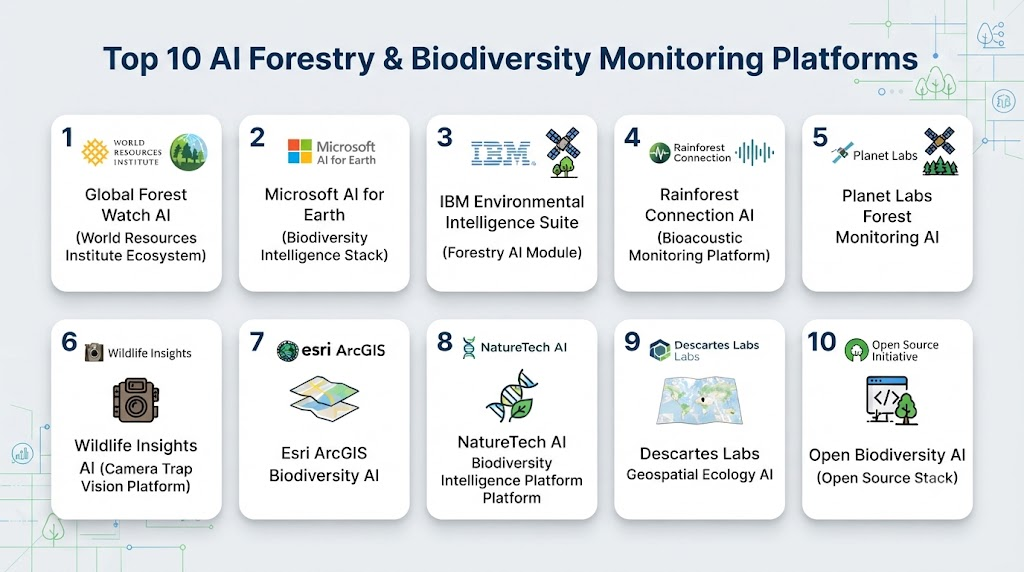
Top 10 AI Forestry & Biodiversity Monitoring Platforms
#1 — Global Forest Watch AI (World Resources Institute Ecosystem)
One-line verdict: Best global platform for real-time deforestation and forest change monitoring.
Short description (2–3 lines):
Global Forest Watch uses satellite imagery and AI models to monitor forest loss, degradation, and land-use changes globally, providing near real-time alerts for deforestation and ecosystem changes.
Standout Capabilities
- Real-time deforestation alerts
- Satellite-based forest change detection
- Global forest cover mapping
- Land-use change analytics
- Fire and degradation monitoring
- Open-access ecological datasets
AI-Specific Depth
- Model support: Geospatial ML + satellite vision models
- RAG / knowledge integration: Global forest + land datasets
- Evaluation: Change detection accuracy metrics
- Guardrails: Environmental validation rules
- Observability: Environmental dashboards
Pros
- Global coverage
- Strong credibility in conservation
- Open and widely used
Cons
- Limited wildlife monitoring depth
- Requires additional analytics layers
Security & Compliance
- Public environmental data governance
Deployment & Platforms
- Cloud-based
Integrations & Ecosystem
- GIS tools
- Climate monitoring platforms
- NGO systems
Pricing Model
Free + enterprise layers
Best-Fit Scenarios
- Governments
- NGOs
- Climate researchers
#2 — Microsoft AI for Earth (Biodiversity Intelligence Stack)
One-line verdict: Best scalable cloud AI ecosystem for biodiversity and environmental monitoring.
Standout Capabilities
- Biodiversity mapping models
- Species distribution prediction
- Forest ecosystem monitoring
- Climate + ecology data fusion
- Conservation analytics pipelines
AI-Specific Depth
- Model support: Azure AI + geospatial ML
- RAG / knowledge integration: Environmental + biodiversity datasets
- Evaluation: Model performance metrics
- Guardrails: Enterprise governance controls
- Observability: Azure dashboards
Pros
- Highly scalable
- Strong AI ecosystem
- Good integration with research workflows
Cons
- Requires technical expertise
- Not out-of-the-box conservation tool
Security & Compliance
- Enterprise Azure security
Deployment & Platforms
- Cloud + hybrid
Integrations & Ecosystem
- GIS systems
- Satellite platforms
- Research tools
Pricing Model
Usage-based
Best-Fit Scenarios
- Large conservation programs
- Governments
- Research institutions
#3 — IBM Environmental Intelligence Suite (Forestry AI Module)
One-line verdict: Best enterprise platform for ecosystem monitoring and climate-linked biodiversity analysis.
Standout Capabilities
- Forest health monitoring
- Climate + biodiversity correlation analysis
- Ecosystem risk prediction
- Land-use change analytics
- Environmental compliance reporting
AI-Specific Depth
- Model support: IBM AI + geospatial models
- RAG / knowledge integration: Environmental datasets
- Evaluation: Ecosystem KPIs
- Guardrails: Governance frameworks
- Observability: Environmental dashboards
Pros
- Strong enterprise reliability
- Multi-domain environmental intelligence
- Good compliance support
Cons
- Complex system setup
- Enterprise-focused
Security & Compliance
- Enterprise governance
- Audit-ready systems
Deployment & Platforms
- Cloud-based IBM ecosystem
Integrations & Ecosystem
- ESG platforms
- GIS systems
- Climate tools
Pricing Model
Enterprise licensing
Best-Fit Scenarios
- Governments
- Large enterprises
- Conservation organizations
#4 — Rainforest Connection AI (Bioacoustic Monitoring Platform)
One-line verdict: Best AI platform for wildlife and illegal logging detection using sound intelligence.
Standout Capabilities
- Bioacoustic wildlife monitoring
- Illegal logging detection via sound
- Species identification using audio AI
- Remote forest monitoring devices
- Real-time alert systems
AI-Specific Depth
- Model support: Audio deep learning + CNN models
- RAG / knowledge integration: Acoustic biodiversity datasets
- Evaluation: Species detection accuracy metrics
- Guardrails: Environmental validation
- Observability: Acoustic dashboards
Pros
- Unique bioacoustic intelligence
- Works in remote forests
- Strong conservation impact
Cons
- Limited visual data integration
- Hardware deployment required
Security & Compliance
- Field device security systems
Deployment & Platforms
- Edge + cloud hybrid
Integrations & Ecosystem
- IoT forest sensors
- Conservation systems
Pricing Model
Nonprofit + enterprise
Best-Fit Scenarios
- Wildlife conservation
- Anti-logging enforcement
- Biodiversity monitoring
#5 — Planet Labs Forest Monitoring AI
One-line verdict: Best high-frequency satellite imaging platform for forest change detection.
Standout Capabilities
- Daily satellite forest monitoring
- Deforestation detection
- Land-use change tracking
- Fire and degradation monitoring
- Ecosystem mapping
AI-Specific Depth
- Model support: Geospatial ML + vision models
- RAG / knowledge integration: Satellite datasets
- Evaluation: Detection accuracy metrics
- Guardrails: Environmental validation
- Observability: Geospatial dashboards
Pros
- Very high revisit frequency
- Strong global coverage
- Reliable imaging
Cons
- Requires AI layer for full insights
- Not biodiversity-specific
Security & Compliance
- Enterprise satellite security
Deployment & Platforms
- Cloud-based
Integrations & Ecosystem
- GIS systems
- Climate analytics platforms
Pricing Model
Subscription
Best-Fit Scenarios
- Governments
- NGOs
- Climate monitoring teams
#6 — Wildlife Insights AI (Camera Trap Vision Platform)
One-line verdict: Best AI platform for automated wildlife detection from camera traps.
Standout Capabilities
- Wildlife species recognition
- Camera trap image classification
- Population tracking analytics
- Habitat monitoring
- Biodiversity reporting
AI-Specific Depth
- Model support: Computer vision + CNN models
- RAG / knowledge integration: Species datasets
- Evaluation: Classification accuracy metrics
- Guardrails: Field validation rules
- Observability: Biodiversity dashboards
Pros
- High species recognition accuracy
- Strong conservation use cases
- Easy camera integration
Cons
- Requires camera infrastructure
- Limited large-scale ecosystem modeling
Security & Compliance
- Research-grade data protection
Deployment & Platforms
- Edge + cloud
Integrations & Ecosystem
- Camera traps
- Conservation databases
Pricing Model
Subscription
Best-Fit Scenarios
- Wildlife reserves
- Conservation NGOs
- Research labs
#7 — Esri ArcGIS Biodiversity AI
One-line verdict: Best geospatial platform for biodiversity mapping and ecosystem modeling.
Standout Capabilities
- Biodiversity mapping
- Habitat classification
- Ecosystem spatial analysis
- Forest change detection
- Conservation planning tools
AI-Specific Depth
- Model support: Geospatial ML models
- RAG / knowledge integration: GIS + biodiversity datasets
- Evaluation: Spatial accuracy metrics
- Guardrails: Environmental validation
- Observability: GIS dashboards
Pros
- Industry-leading GIS platform
- Strong mapping capabilities
- High flexibility
Cons
- Requires GIS expertise
- Complex configuration
Security & Compliance
- Enterprise GIS security
Deployment & Platforms
- Cloud + on-prem
Integrations & Ecosystem
- GIS tools
- Environmental datasets
Pricing Model
Enterprise
Best-Fit Scenarios
- Government planning
- Environmental agencies
- Conservation mapping
#8 — NatureTech AI Biodiversity Intelligence Platform
One-line verdict: Best AI platform for biodiversity risk and ecosystem intelligence.
Standout Capabilities
- Biodiversity risk scoring
- Ecosystem health monitoring
- Species distribution modeling
- Conservation prioritization
- Climate impact analysis
AI-Specific Depth
- Model support: ML + ecological models
- RAG / knowledge integration: Biodiversity datasets
- Evaluation: Risk scoring metrics
- Guardrails: Environmental constraints
- Observability: Ecological dashboards
Pros
- Strong biodiversity focus
- Good risk modeling
- Easy analytics
Cons
- Smaller ecosystem
- Limited field hardware integration
Security & Compliance
- Research-grade governance
Deployment & Platforms
- Cloud-based
Integrations & Ecosystem
- GIS systems
- Climate platforms
Pricing Model
Subscription
Best-Fit Scenarios
- NGOs
- Biodiversity researchers
- Policy organizations
#9 — Descartes Labs Geospatial Ecology AI
One-line verdict: Best geospatial AI platform for large-scale ecosystem monitoring.
Standout Capabilities
- Satellite-driven ecosystem monitoring
- Forest change detection
- Land-use analytics
- Biodiversity mapping support
- Environmental risk modeling
AI-Specific Depth
- Model support: Geospatial ML models
- RAG / knowledge integration: Satellite datasets
- Evaluation: Detection KPIs
- Guardrails: Environmental validation
- Observability: Geospatial dashboards
Pros
- Strong geospatial analytics
- Scalable platform
- Good ecosystem modeling
Cons
- Requires technical expertise
- Not wildlife-specific
Security & Compliance
- Enterprise security
Deployment & Platforms
- Cloud-based
Integrations & Ecosystem
- Satellite systems
- GIS platforms
Pricing Model
Enterprise
Best-Fit Scenarios
- Governments
- Climate research
- Environmental analytics
#10 — Open Biodiversity AI (Open Source Stack)
One-line verdict: Best open-source framework for building custom forestry and biodiversity monitoring systems.
Standout Capabilities
- Custom biodiversity models
- Forest monitoring pipelines
- Wildlife detection models
- Satellite + sensor fusion
- Edge AI deployment support
AI-Specific Depth
- Model support: Open ML + vision models
- RAG / knowledge integration: Fully customizable datasets
- Evaluation: Developer-defined metrics
- Guardrails: None built-in
- Observability: Custom dashboards
Pros
- Fully flexible
- No vendor lock-in
- Ideal for research innovation
Cons
- Requires expertise
- No enterprise support
Security & Compliance
- Depends on deployment
Deployment & Platforms
- Self-hosted / hybrid
Integrations & Ecosystem
- GIS systems
- IoT sensors
- Satellite data pipelines
Pricing Model
Open-source
Best-Fit Scenarios
- Research labs
- AI conservation startups
- Custom biodiversity systems
Comparison Table
| Tool Name | Best For | Deployment | Model Flexibility | Strength | Watch-Out | Public Rating |
|---|---|---|---|---|---|---|
| Global Forest Watch | Deforestation | Cloud | Open | Coverage | Limited wildlife | N/A |
| Microsoft AI for Earth | Ecosystems | Cloud | ML models | Scalability | Complexity | N/A |
| IBM Env Intelligence | Enterprise ecology | Cloud | Hybrid | Governance | Complexity | N/A |
| Rainforest Connection | Wildlife audio | Edge | Audio ML | Bioacoustics | Hardware need | N/A |
| Planet Labs | Satellite forests | Cloud | ML models | Frequency | Needs AI layer | N/A |
| Wildlife Insights | Camera traps | Edge | Vision models | Species ID | Limited scale | N/A |
| Esri ArcGIS | GIS biodiversity | Hybrid | ML models | Mapping | Expertise needed | N/A |
| NatureTech AI | Biodiversity risk | Cloud | ML models | Risk analytics | Smaller ecosystem | N/A |
| Descartes Labs | Geospatial AI | Cloud | ML models | Scale | Complexity | N/A |
| Open Biodiversity AI | Custom systems | Self-hosted | Open-source | Flexibility | No support | N/A |
Scoring & Evaluation (Transparent Rubric)
| Tool | Core | Reliability | Guardrails | Integrations | Ease | Perf/Cost | Security/Admin | Support | Weighted Total |
|---|---|---|---|---|---|---|---|---|---|
| Global Forest Watch | 9 | 9 | 8 | 8 | 8 | 9 | 8 | 8 | 8.4 |
| Microsoft | 9 | 9 | 9 | 9 | 7 | 8 | 9 | 9 | 8.6 |
| IBM | 9 | 9 | 9 | 8 | 7 | 8 | 9 | 9 | 8.5 |
| Rainforest Conn | 9 | 9 | 8 | 8 | 7 | 8 | 8 | 8 | 8.3 |
| Planet Labs | 8 | 9 | 8 | 8 | 7 | 8 | 8 | 8 | 8.2 |
| Wildlife Insights | 8 | 8 | 8 | 8 | 8 | 8 | 8 | 8 | 8.0 |
| Esri ArcGIS | 9 | 9 | 9 | 9 | 6 | 8 | 9 | 9 | 8.5 |
| NatureTech AI | 8 | 8 | 8 | 8 | 8 | 8 | 8 | 8 | 8.0 |
| Descartes Labs | 8 | 9 | 8 | 8 | 7 | 8 | 8 | 8 | 8.2 |
| Open Biodiversity AI | 8 | 7 | 6 | 7 | 6 | 9 | 6 | 7 | 7.2 |
Which Forestry & Biodiversity AI Tool Is Right for You?
Governments & Environmental Agencies
Best fit: Global Forest Watch, IBM, Esri ArcGIS
Focus: monitoring + policy enforcement
Wildlife Conservation NGOs
Best fit: Rainforest Connection, Wildlife Insights
Focus: species monitoring + protection
Climate Research Institutions
Best fit: Microsoft AI for Earth, Descartes Labs
Focus: ecosystem modeling
Satellite Monitoring Teams
Best fit: Planet Labs, Global Forest Watch
Focus: deforestation tracking
Developers & AI Teams
Best fit: Open Biodiversity AI
Focus: flexibility + experimentation
Implementation Playbook (30 / 60 / 90 Days)
30 Days: Setup
- Define ecosystem monitoring scope
- Collect satellite, sensor, and camera data
- Identify biodiversity KPIs
60 Days: Integration
- Deploy AI vision and geospatial models
- Integrate satellite + IoT pipelines
- Enable real-time monitoring dashboards
90 Days: Scale
- Expand to multi-region monitoring
- Automate deforestation alerts
- Integrate biodiversity reporting systems
- Deploy predictive ecosystem models
Common Mistakes & How to Avoid Them
- Ignoring multi-modal data fusion
- Poor camera trap placement strategy
- Weak species labeling datasets
- Over-reliance on satellite-only data
- No acoustic monitoring integration
- Lack of edge AI in remote forests
- Poor GIS integration
- Missing seasonal biodiversity patterns
- No model retraining strategy
- Ignoring false positive alerts
- Weak conservation validation loops
- Vendor lock-in risks
- No ecosystem-level modeling
- Underestimating field deployment challenges
FAQs
What is AI forestry monitoring?
It is AI-based tracking of forests using satellites, sensors, and drones.
What is biodiversity monitoring?
It tracks species and ecosystem health using AI systems.
Can AI detect illegal logging?
Yes, via satellite and drone imagery.
Does it use sound data?
Yes, bioacoustic AI is widely used.
Can it track animals?
Yes, via camera traps and vision models.
Is it real-time?
Increasingly, yes.
What data is used?
Satellite, audio, images, and sensor data.
Who uses it?
Governments, NGOs, and researchers.
Can it predict deforestation?
Yes, using predictive AI models.
Is open-source available?
Yes, but requires expertise.
What is the biggest challenge?
Data integration across modalities.
Can it support climate reporting?
Yes, especially carbon sink estimation.
Conclusion
AI Forestry & Biodiversity Monitoring is becoming essential for protecting ecosystems, preventing deforestation, and understanding global biodiversity changes. It combines satellite intelligence, computer vision, and bioacoustic AI to deliver continuous environmental awareness.The best platform depends on need: global monitoring systems lead deforestation tracking, conservation tools focus on wildlife protection, and open frameworks enable innovation.
Find Trusted Cardiac Hospitals
Compare heart hospitals by city and services — all in one place.
Explore Hospitals