Introduction
AI Satellite-Based Emissions Detection refers to the use of artificial intelligence combined with satellite imagery, remote sensing data, and atmospheric modeling to detect, measure, and attribute greenhouse gas emissions—especially methane (CH₄), carbon dioxide (CO₂), and industrial pollutants—at a global scale.
In 2026 and beyond, emissions monitoring is shifting from self-reported estimates to independent, verifiable, satellite-driven measurement systems. Governments, regulators, investors, and ESG auditors are increasingly demanding transparent emissions tracking that cannot be manipulated by manual reporting.
Modern systems combine hyperspectral satellite imagery, infrared sensing, geospatial AI models, and physics-based atmospheric simulations to detect emission plumes, estimate quantities, and identify sources such as oil & gas infrastructure, power plants, shipping routes, and industrial zones.
Key real-world use cases:
- Methane leak detection in oil & gas infrastructure
- CO₂ emission monitoring from power plants
- Industrial pollution tracking and compliance monitoring
- Supply chain emissions verification
- ESG audit and carbon reporting validation
- Illegal emissions detection (unreported flaring, leaks)
- National greenhouse gas inventory verification
Key evaluation criteria:
- Detection accuracy for methane/CO₂ plumes
- Satellite resolution (spatial + spectral)
- Latency of emissions detection
- Source attribution accuracy (who emitted what)
- Integration with geospatial AI pipelines
- Multi-satellite data fusion capability
- Regulatory reporting compatibility
- Real-time alerting capability
- Scalability across global coverage
- Explainability and audit traceability
Best for: Governments, environmental agencies, oil & gas companies, ESG auditors, carbon markets, climate-tech companies, and institutional investors.
Not ideal for: Small businesses without industrial or large-scale emissions exposure.
What’s Changed in AI Satellite Emissions Detection in 2026+
- Shift from periodic satellite scans to continuous emissions monitoring constellations
- Increased use of AI-powered hyperspectral plume detection models
- Integration of multi-satellite fusion (Sentinel, Landsat, commercial constellations)
- Real-time detection of methane super-emitters using AI anomaly systems
- Expansion of carbon market verification using satellite evidence
- Use of graph neural networks for emission source attribution
- Adoption of digital twin atmospheric models
- Strong regulatory push for independent emissions verification
- AI-driven classification of industrial vs natural emissions sources
- Automated integration with ESG and carbon accounting platforms
- Increased use of edge AI processing on satellite data pipelines
- Development of AI agents for autonomous environmental monitoring
Quick Buyer Checklist (Satellite Emissions Platforms)
Before selecting a platform, evaluate:
- Satellite resolution and coverage frequency
- Methane and CO₂ detection sensitivity
- Source attribution accuracy
- Multi-satellite data fusion capability
- Real-time or near real-time detection speed
- Atmospheric correction model accuracy
- Integration with ESG/carbon platforms
- Regulatory reporting support
- Historical data availability
- API access and scalability
- False positive rate
- Auditability and explainability
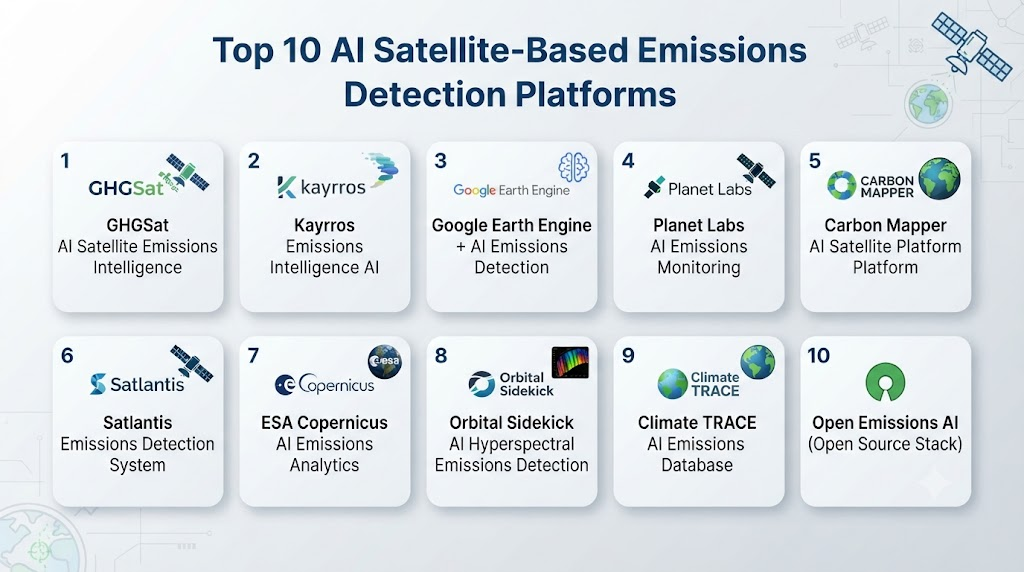
Top 10 AI Satellite-Based Emissions Detection Platforms
#1 — GHGSat AI Satellite Emissions Intelligence
One-line verdict: Best high-resolution methane emissions detection platform for industrial monitoring.
Short description (2–3 lines):
GHGSat uses high-resolution satellites and AI analytics to detect and quantify greenhouse gas emissions at facility level, focusing heavily on methane leaks from industrial sources such as oil and gas infrastructure.
Standout Capabilities
- Facility-level methane leak detection
- High-resolution plume mapping
- Industrial emissions quantification
- Rapid emissions alerting system
- Asset-level emissions attribution
- Regulatory compliance reporting
AI-Specific Depth
- Model support: Proprietary AI + physics-based plume models
- RAG / knowledge integration: Satellite + industrial asset datasets
- Evaluation: Emissions detection accuracy scoring
- Guardrails: Regulatory validation frameworks
- Observability: Emissions tracking dashboards
Pros
- Extremely high detection accuracy
- Strong industrial focus
- Trusted in oil & gas sector
Cons
- Limited to specific gases (mainly methane focus)
- Enterprise-only pricing
Security & Compliance
- Enterprise-grade controls
- Audit-ready emissions verification
Deployment & Platforms
- Cloud-based analytics platform
Integrations & Ecosystem
- ESG platforms
- Oil & gas monitoring systems
- Carbon reporting tools
Pricing Model
Enterprise subscription
Best-Fit Scenarios
- Oil & gas companies
- Environmental regulators
- ESG verification agencies
#2 — Kayrros Emissions Intelligence AI
One-line verdict: Best for large-scale satellite analytics and global emissions intelligence.
Standout Capabilities
- Global methane emission tracking
- Industrial emissions monitoring
- Oil & gas infrastructure surveillance
- Supply chain emissions detection
- Super-emitter identification
AI-Specific Depth
- Model support: AI + geospatial ML models
- RAG / knowledge integration: Satellite + industrial datasets
- Evaluation: Emissions anomaly scoring
- Guardrails: Environmental validation frameworks
- Observability: Geospatial dashboards
Pros
- Strong global coverage
- Excellent anomaly detection
- High analytical depth
Cons
- Less granular facility-level precision than GHGSat
- Complex analytics workflows
Security & Compliance
- Enterprise-grade environmental data governance
Deployment & Platforms
- Cloud-based
Integrations & Ecosystem
- ESG platforms
- Government monitoring systems
- Energy analytics tools
Pricing Model
Enterprise licensing
Best-Fit Scenarios
- Governments
- Energy companies
- Climate research organizations
#3 — Google Earth Engine + AI Emissions Detection
One-line verdict: Best scalable geospatial AI platform for emissions modeling and analysis.
Standout Capabilities
- Satellite-based emissions modeling
- Atmospheric data processing
- Large-scale geospatial AI analysis
- Historical emissions trend tracking
- Custom emissions detection models
AI-Specific Depth
- Model support: Vertex AI + geospatial ML models
- RAG / knowledge integration: Satellite + climate datasets
- Evaluation: Model validation metrics
- Guardrails: Limited built-in controls
- Observability: Analytics dashboards
Pros
- Massive scalability
- Rich geospatial dataset ecosystem
- Highly flexible
Cons
- Requires advanced ML expertise
- Not out-of-the-box emissions tool
Security & Compliance
- Enterprise cloud security
Deployment & Platforms
- Cloud-native (Google Cloud)
Integrations & Ecosystem
- BigQuery
- Vertex AI
- Climate datasets
Pricing Model
Usage-based
Best-Fit Scenarios
- Research institutions
- Climate modeling teams
- Government agencies
#4 — Planet Labs AI Emissions Monitoring
One-line verdict: Best for high-frequency Earth observation and emissions change detection.
Standout Capabilities
- High-frequency satellite imaging
- Land-use emissions tracking
- Industrial site monitoring
- Change detection analytics
- Environmental monitoring pipelines
AI-Specific Depth
- Model support: AI-based image analysis models
- RAG / knowledge integration: Satellite imagery datasets
- Evaluation: Detection accuracy metrics
- Guardrails: Environmental data validation
- Observability: Geospatial dashboards
Pros
- High revisit frequency
- Strong imaging capabilities
- Good global coverage
Cons
- Requires additional AI modeling layer
- Not emissions-specific out of the box
Security & Compliance
- Enterprise security standards
Deployment & Platforms
- Cloud-based
Integrations & Ecosystem
- GIS systems
- Climate analytics platforms
Pricing Model
Subscription-based
Best-Fit Scenarios
- Environmental monitoring
- Government surveillance
- ESG analytics teams
#5 — Carbon Mapper AI Satellite Platform
One-line verdict: Best for public-interest methane and CO₂ emissions transparency.
Standout Capabilities
- Methane super-emitter detection
- CO₂ emissions mapping
- Public emissions transparency dashboards
- Satellite plume detection
- Climate accountability tracking
AI-Specific Depth
- Model support: AI + atmospheric physics models
- RAG / knowledge integration: Satellite + environmental datasets
- Evaluation: Emissions validation metrics
- Guardrails: Scientific validation frameworks
- Observability: Climate dashboards
Pros
- Strong transparency mission
- Public accessibility focus
- High scientific credibility
Cons
- Less enterprise customization
- Limited commercial integrations
Security & Compliance
- Public environmental data standards
Deployment & Platforms
- Cloud-based
Integrations & Ecosystem
- Climate research tools
- ESG reporting systems
Pricing Model
Mixed (public + enterprise models)
Best-Fit Scenarios
- Climate NGOs
- Governments
- Research institutions
#6 — Satlantis AI Emissions Detection System
One-line verdict: Best for ultra-high-resolution industrial emissions imaging.
Standout Capabilities
- Ultra-high-resolution satellite imaging
- Industrial emissions detection
- Methane leak identification
- Facility-level monitoring
- Environmental surveillance
AI-Specific Depth
- Model support: Proprietary AI imaging models
- RAG / knowledge integration: Satellite + industrial datasets
- Evaluation: Detection precision metrics
- Guardrails: Environmental validation rules
- Observability: Imaging dashboards
Pros
- Extremely high-resolution imagery
- Strong industrial applications
- Precise detection capability
Cons
- Expensive infrastructure
- Limited analytics ecosystem
Security & Compliance
- Enterprise-grade controls
Deployment & Platforms
- Cloud-based
Integrations & Ecosystem
- GIS platforms
- Environmental systems
Pricing Model
Enterprise
Best-Fit Scenarios
- Oil & gas monitoring
- Industrial compliance
- Regulatory agencies
#7 — ESA Copernicus AI Emissions Analytics
One-line verdict: Best public satellite dataset for emissions detection and climate monitoring.
Standout Capabilities
- Global emissions monitoring
- Atmospheric gas tracking
- Environmental change detection
- Long-term climate datasets
- Open geospatial data access
AI-Specific Depth
- Model support: Open geospatial models
- RAG / knowledge integration: Copernicus satellite data
- Evaluation: Scientific validation metrics
- Guardrails: Environmental data standards
- Observability: Research dashboards
Pros
- Free and open data access
- Strong global coverage
- Scientific credibility
Cons
- Requires AI modeling layer
- Not a ready-made product
Security & Compliance
- Public research-grade data
Deployment & Platforms
- Open satellite infrastructure
Integrations & Ecosystem
- GIS tools
- Climate research platforms
Pricing Model
Free / public access
Best-Fit Scenarios
- Researchers
- Governments
- Climate scientists
#8 — Orbital Sidekick AI Hyperspectral Emissions Detection
One-line verdict: Best for hyperspectral AI emissions detection and chemical analysis.
Standout Capabilities
- Hyperspectral emissions detection
- Chemical plume identification
- Industrial leak detection
- Environmental monitoring
- Gas composition analysis
AI-Specific Depth
- Model support: Hyperspectral AI models
- RAG / knowledge integration: Spectral + atmospheric data
- Evaluation: Detection accuracy metrics
- Guardrails: Scientific validation
- Observability: Spectral dashboards
Pros
- Advanced hyperspectral technology
- High chemical detection accuracy
- Strong industrial use cases
Cons
- Complex data interpretation
- Enterprise-focused
Security & Compliance
- Industrial-grade controls
Deployment & Platforms
- Cloud-based
Integrations & Ecosystem
- Climate platforms
- Industrial monitoring systems
Pricing Model
Enterprise
Best-Fit Scenarios
- Industrial emissions monitoring
- Chemical plants
- Energy sector
#9 — Climate TRACE AI Emissions Database
One-line verdict: Best global AI-driven emissions tracking database for transparency.
Standout Capabilities
- Global emissions tracking
- Multi-sector emissions mapping
- AI-based emissions estimation
- Public climate transparency tools
- Country-level emissions analysis
AI-Specific Depth
- Model support: AI estimation models
- RAG / knowledge integration: Global emissions datasets
- Evaluation: Emissions validation metrics
- Guardrails: Scientific validation standards
- Observability: Public dashboards
Pros
- Very large global dataset
- High transparency
- Multi-sector coverage
Cons
- Not facility-level precise
- Limited real-time monitoring
Security & Compliance
- Public data governance
Deployment & Platforms
- Cloud-based
Integrations & Ecosystem
- Climate research tools
- ESG platforms
Pricing Model
Free / public access
Best-Fit Scenarios
- Governments
- Researchers
- Policy makers
#10 — Open Emissions AI (Open Source Stack)
One-line verdict: Best open-source framework for building custom satellite emissions detection systems.
Standout Capabilities
- Custom emissions detection pipelines
- Satellite data processing
- Geospatial AI modeling
- Plume detection algorithms
- Flexible environmental analytics
AI-Specific Depth
- Model support: Open ML + geospatial models
- RAG / knowledge integration: Fully customizable
- Evaluation: Developer-defined metrics
- Guardrails: None built-in
- Observability: Custom dashboards
Pros
- Full flexibility
- No vendor lock-in
- Ideal for research innovation
Cons
- Requires advanced expertise
- No enterprise support
Security & Compliance
- Depends on deployment
Deployment & Platforms
- Self-hosted / hybrid
Integrations & Ecosystem
- GIS systems
- Cloud platforms
- Satellite pipelines
Pricing Model
Open-source
Best-Fit Scenarios
- Research labs
- Climate startups
- Engineering teams
Comparison Table
| Tool Name | Best For | Deployment | Model Flexibility | Strength | Watch-Out | Public Rating |
|---|---|---|---|---|---|---|
| GHGSat | Methane detection | Cloud | Proprietary | Accuracy | Narrow gas focus | N/A |
| Kayrros | Global emissions | Cloud | AI models | Coverage | Complexity | N/A |
| Google Earth Engine | Geospatial AI | Cloud | Multi-model | Scalability | Setup complexity | N/A |
| Planet Labs | Satellite imaging | Cloud | AI imaging | Frequency | Needs modeling | N/A |
| Carbon Mapper | Transparency | Cloud | Scientific AI | Public data | Limited enterprise | N/A |
| Satlantis | High-res imaging | Cloud | Proprietary | Precision | Cost | N/A |
| Copernicus | Open data | Open | Open-source | Coverage | Requires modeling | N/A |
| Orbital Sidekick | Hyperspectral AI | Cloud | Spectral AI | Chemical detection | Complexity | N/A |
| Climate TRACE | Global dataset | Cloud | AI estimation | Transparency | Low granularity | N/A |
| Open Emissions AI | Custom systems | Self-hosted | Open-source | Flexibility | No support | N/A |
Scoring & Evaluation (Transparent Rubric)
| Tool | Core | Reliability | Guardrails | Integrations | Ease | Perf/Cost | Security/Admin | Support | Weighted Total |
|---|---|---|---|---|---|---|---|---|---|
| GHGSat | 9 | 9 | 9 | 8 | 7 | 8 | 9 | 9 | 8.5 |
| Kayrros | 9 | 9 | 8 | 8 | 7 | 8 | 8 | 8 | 8.3 |
| 9 | 9 | 8 | 9 | 7 | 8 | 9 | 9 | 8.6 | |
| Planet | 8 | 9 | 8 | 8 | 8 | 8 | 8 | 8 | 8.2 |
| Carbon Mapper | 8 | 8 | 9 | 8 | 8 | 8 | 8 | 8 | 8.1 |
| Satlantis | 9 | 9 | 8 | 8 | 7 | 7 | 9 | 8 | 8.3 |
| Copernicus | 8 | 8 | 9 | 8 | 8 | 9 | 8 | 8 | 8.3 |
| Orbital Sidekick | 9 | 9 | 8 | 8 | 7 | 8 | 9 | 8 | 8.4 |
| Climate TRACE | 8 | 8 | 9 | 8 | 8 | 9 | 8 | 8 | 8.3 |
| Open Emissions AI | 8 | 7 | 6 | 7 | 6 | 9 | 6 | 7 | 7.2 |
Which Satellite Emissions Tool Is Right for You?
Oil & Gas Companies
Best fit: GHGSat, Satlantis, Orbital Sidekick
Focus: facility-level methane detection
Governments & Regulators
Best fit: Kayrros, Copernicus, Climate TRACE
Focus: national emissions tracking
Climate Research Teams
Best fit: Google Earth Engine, Copernicus
Focus: modeling + analysis
ESG & Carbon Reporting Teams
Best fit: Carbon Mapper, Kayrros
Focus: verification + transparency
Developers & Startups
Best fit: Open Emissions AI
Focus: flexibility + innovation
Implementation Playbook (30 / 60 / 90 Days)
30 Days: Setup
- Define emissions monitoring objectives
- Select satellite data sources
- Establish baseline emission maps
60 Days: Integration
- Deploy AI detection pipelines
- Integrate geospatial analytics systems
- Validate emission detection accuracy
90 Days: Scale
- Enable real-time emissions monitoring
- Automate ESG reporting integration
- Deploy global monitoring dashboards
- Connect to carbon markets and compliance systems
Common Mistakes & How to Avoid Them
- Ignoring atmospheric correction errors
- Over-relying on single satellite source
- Poor plume attribution models
- Lack of temporal resolution alignment
- Weak integration with ESG systems
- No validation with ground truth data
- Misinterpreting natural vs industrial emissions
- Missing multi-satellite fusion
- No explainability in AI models
- Underestimating data processing complexity
- Poor regulatory alignment
- No real-time alerting system
- Vendor lock-in risks
- Ignoring seasonal emission variations
FAQs
What is satellite-based emissions detection?
It is the use of satellites and AI to detect greenhouse gas emissions from space.
What gases can be detected?
Methane, CO₂, and industrial pollutants.
How accurate is it?
Accuracy depends on satellite resolution and AI models.
Can it detect leaks?
Yes, especially methane leaks from industrial facilities.
Is it real-time?
Some platforms provide near real-time monitoring.
Who uses it?
Governments, energy companies, and ESG organizations.
Is it used for regulation?
Yes, increasingly for compliance verification.
Can it track global emissions?
Yes, but granularity varies.
What is a super-emitter?
A large emission source detected from space.
Is open-source available?
Yes, but requires advanced expertise.
Can it replace ground sensors?
No, it complements them.
What is the biggest challenge?
Source attribution accuracy.
Conclusion
AI Satellite-Based Emissions Detection is revolutionizing how the world measures and verifies greenhouse gas emissions. It enables independent, transparent, and scalable monitoring of climate-impacting activities across industries and geographies.The best platform depends on use case: industrial players need high-resolution detection, governments require global coverage, and researchers focus on modeling flexibility.
Find Trusted Cardiac Hospitals
Compare heart hospitals by city and services — all in one place.
Explore Hospitals